- Start with a specific question about how you would use the home, then find the relevant current official files.
- Planning direction, current rules, project decisions and construction records have different jobs and dates.
- Read the actual drawing version, status and local process. A proposal or approval does not promise an impact, completion date or future value.
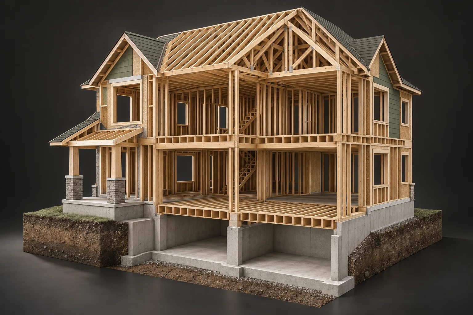
Conceptual architecture. Layout, sizes and routes are illustrative; the picture does not describe your home’s condition.
Explore this in the visual atlas ↗2 picture lessons appear beside the questions in this guide. Use them to understand the explanation, then consider what it means for your home.
How could the surroundings affect your plans?
A home’s surroundings influence ordinary life: daylight in a room, privacy at the rear window, a route to work or access to the driveway. Start with the things you would rely on if you bought the home. Write them as specific questions, such as “What is proposed beside this window?” or “Which road project could affect this entrance?”
Separate today’s surroundings from possible change. A street visit shows conditions at that time. Land-use rules describe what may be allowed under the applicable framework. An application describes a proposal, and a decision addresses that particular file. A finished building is another situation. Keeping these roles separate lets you investigate a concern without treating every drawing as a promised future.
Choose research based on the question rather than a fixed search radius. An adjacent proposal may matter to privacy; a more distant road or drainage project may matter to access or services. Ask municipal staff which records are relevant. This guide uses clearly labelled Calgary and Toronto examples; file names, legal processes and public access differ across Canada.
Where do you find official nearby-project records?
Begin with the municipality’s planning or development portal. Search the home’s address and the nearby parcels relevant to your concern. Record each file number, application type, address, status and the date you checked it. If a site notice provides a number, use it to locate the specific file instead of relying on a broad map marker or a neighbour’s description.
Calgary’s Development Map, or DMap, supports searches by address, reference number, community and map location. Its guide explains how to open application details and submitted plans. Look for multiple related applications at the same location and review the actual detail page. The map is a way into the file; a marker is not the decision or complete project record.
Ask for help when an important drawing is absent or an older file is no longer available online. Calgary’s FAQ says not all application information is public and submitted plans have a limited online viewing period. Confirm the responsible office’s current access process. An unsuccessful search does not prove that no application, older approval or other relevant record exists.
How are planning rules different from a project proposal?
Land-use or zoning rules describe the applicable uses and development rules for an area or parcel. A proposal asks for something specific: a change of use, different rules, a new building or another form of approval. Read the current rules and the application separately. A proposal to change a rule is not the same as an adopted change.
Calgary distinguishes land-use redesignation from development-permit applications. Toronto’s Development Guide identifies its own application families, including official-plan and zoning amendments, site-plan control and minor variances. These are local examples of different questions and processes. Do not assume every Canadian project passes through the same named files or in one fixed sequence.
Use four parallel record categories: planning direction, current rules, the specific proposal and its decision, and construction or completion records where relevant. Each has its own date and scope. The diagram gives these categories equal space because none silently answers the others. Ask municipal staff how the actual files connect for the proposal you are reviewing.
Read four planning record categories separately
Four parallel cards describe different record categories. The card headings are planning direction, current rules, project file and construction records.
Numbers identify the parts explained below.
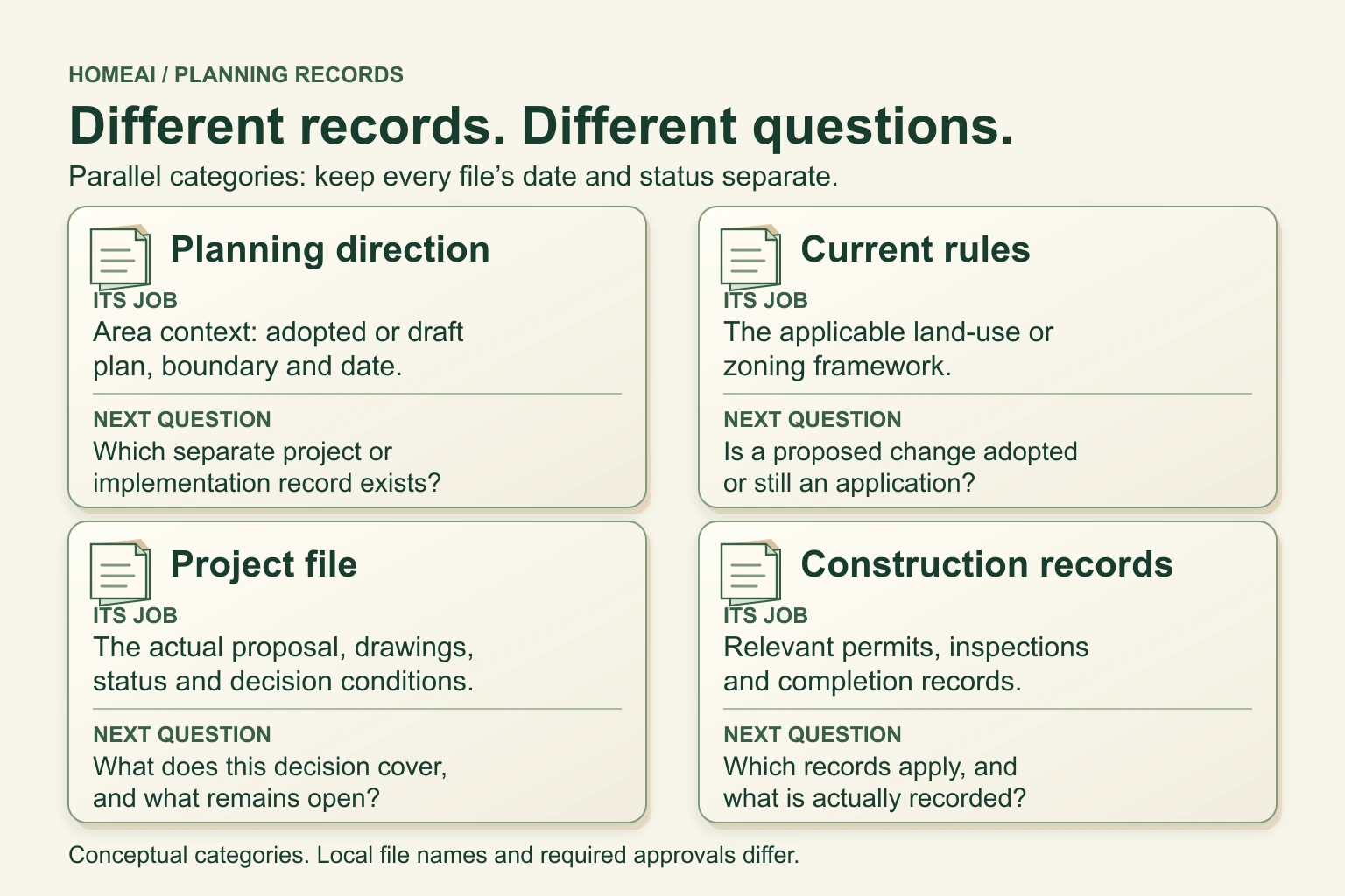
- Planning direction
An adopted or draft area plan supplies policy context. Read its status, boundary and date. Next question: Which separate project or implementation records address the feature you would rely on?
- Current rules
The applicable land-use or zoning rules describe the framework for the parcel. Next question: Is a proposed rule change adopted, or is it still an application?
- Project file
The particular proposal, drawings and decision have their own versions, status and conditions. Next question: What does this decision cover, and which related file or condition remains open?
- Construction records
Relevant permits, inspections and completion records cover their described work. Next question: Which records apply to this project, and what has the authority actually recorded?
What does this illustration leave out?
These are conceptual categories, not records for a particular site. File names, required approvals and dependencies vary locally. Ask municipal staff how the actual records connect and keep every file’s date and status separate. Use the actual municipality, file number, drawing revision and date checked. No promised approval or construction schedule is shown.
Which record describes policy, rules, the project decision or construction, and which separate question still needs an answer?
Explore this with HomeAI ↗Opens an editable question. Nothing is sent until you choose to send it.Different records answer different planning questions.
Read these categories in parallel. They are not a universal approval sequence, and no category silently supplies another file’s decision, permit or completion record.
- Planning direction
- Its job: An adopted or draft area plan supplies policy context. Read its status, boundary and date.
- Next question: Which separate project or implementation records address the feature you would rely on?
- Current rules
- Its job: The applicable land-use or zoning rules describe the framework for the parcel.
- Next question: Is a proposed rule change adopted, or is it still an application?
- Project file
- Its job: The particular proposal, drawings and decision have their own versions, status and conditions.
- Next question: What does this decision cover, and which related file or condition remains open?
- Construction records
- Its job: Relevant permits, inspections and completion records cover their described work.
- Next question: Which records apply to this project, and what has the authority actually recorded?
Four record categories, four different jobs
- Planning directionAn adopted or draft plan gives area context. Check its status, boundary and date; it does not schedule a particular build.
- Current land-use rulesThe relevant designation and rules describe the applicable framework. A proposed change still needs its own decision.
- Project proposal and decisionRead the exact file, drawings, revisions, status and decision conditions. Keep related applications on separate lines.
- Construction and completionAsk which relevant permits and completion records exist and what they cover. An earlier planning approval does not answer these questions.
What does a local plan tell you?
A local plan explains intended direction for an area: where growth, amenities or other changes may be considered. It helps you understand the context in which a proposal is reviewed. Read the plan’s actual geographic boundary and status, and distinguish an adopted plan from a draft still being discussed.
Calgary describes Area Structure Plans as guides for undeveloped land and Local Area Plans as direction for established communities. Those descriptions explain their planning roles. They do not provide a promised construction date for a particular building, road or amenity. For a feature that matters to your purchase, ask which separate project, funding or implementation records exist.
Keep a practical note: the relevant plan, the part that affects your question, its date and any project-specific answer still needed. If a listing promises a future park or transit connection, request the current official record behind that statement. Do not base the decision on a predicted completion date or future resale value that the records do not establish.
What does the application status actually mean?
Read a status together with the application type and the municipality’s explanation. “Submitted” describes receipt; “under review” describes a process still underway. “Approved” directs you to the actual decision and any conditions. Find the dated decision document and relevant drawing revision before treating a short portal label as a full answer.
Calgary’s development-permit process describes approval conditions that must be addressed before the permit is released, with applicability exceptions. Its land-use redesignation process is different. Use those distinctions to ask about this actual file; do not import a universal advertising period, appeal right or timetable. Current instructions and legal advice are needed for any time-sensitive participation or appeal question.
Keep related files on separate lines. A land-use decision, development application and building-permit record can concern the same site while showing different statuses. Ask the file manager which dependencies remain and what the latest decision covers. An approval does not promise that a developer will build, that conditions have been met or that construction will finish by a particular date.
How do you read plans for height, windows and shade?
Start with the drawing’s title, date, revision and status. A site plan shows the proposed arrangement from above; elevations show exterior faces. Find your home and the side of the proposal relevant to your concern. Ask a qualified person to explain heights, openings, orientation and setbacks using the actual drawings and reliable location information.
For privacy, identify the proposed window or balcony and the room or outdoor area you care about. For daylight, ask what a shadow study models, including its dates, times and geometry assumptions. A sunny showing, a perspective rendering and a modelled shadow answer different questions. Calgary’s DMap guide describes conceptual daylight tools; they do not replace a project-specific assessment of your home.
The skeleton picture in this chapter uses fictional geometry to help you find these relationships. It is not a survey, approved proposal or shadow calculation. If an impact could change your decision, request the relevant drawing version and appropriately qualified interpretation. Keep missing dimensions or location information visible instead of inventing an angle, distance or impact percentage.
Read the surroundings as part of your buying question
The room, taller building and road sit in one fictional surroundings model. Use them to name the height, facing-window and access questions you want the actual plans to answer.
Numbers identify the parts explained below.
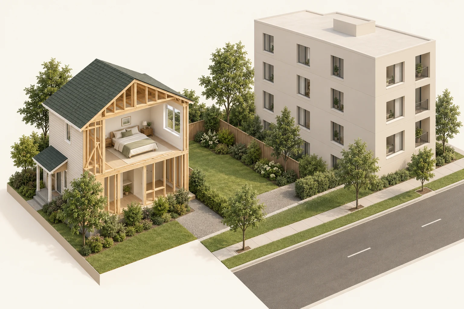
- Your intended use
A room and window introduce questions about how you want to use the home and what surroundings matter to you.
- Nearby building form
Height and facing windows are plan-reading questions. The model is not a real proposal or an approved project.
- Road and access
Look beyond the parcel at the relevant road, sidewalk and access connections, using the actual official records.
What does this illustration leave out?
This is fictional, unscaled geometry with no surveyed parcel boundary, active construction, approval or shadow/privacy calculation. Real implications depend on the site, drawing version, project status and relevant assessment; no future timing or property-value effect is established. Ask the municipality or appropriate planning professional about the actual file and unresolved status or drawing questions.
Which current drawings and application status explain the neighboring height, window orientation and access questions that could affect my use of this home?
Explore this with HomeAI ↗Opens an editable question. Nothing is sent until you choose to send it.What can you learn from a safe neighbourhood visit?
A visit helps connect your everyday needs with the map. From lawful public places or authorized property access, observe the route, entrances, visible work and surroundings. Note the date, time, weather and viewpoint. An observation at one moment is useful context, rather than a measurement of every season, workday or future condition.
Ask targeted questions: can you find the entrance described in the listing, and does a visible site notice identify the application? For an access or transportation concern, look for the responsible authority’s current project records. Do not enter a construction site, climb for a view or investigate shared equipment without authorization. A fence or materials on site does not establish the permissions or project stage.
Keep observed conditions separate from assumptions about the people who live nearby. For the building decision, use relevant plans, recorded observations and qualified assessment. If noise or another measured impact is central to your intended use, ask the appropriate professional what method and observation period would answer the question. A brief visit alone does not supply that assessment.
What do construction and completion records cover?
Planning records and construction records have different jobs. Ask which permit authorizes the described work and what its current status means. Then ask which inspections or completion records apply to that project. A planning decision, a building-permit entry and a completion record should each remain attached to their own scope.
Calgary’s Development Completion Permit checks completed development against approved development plans and conditions. Its current page expressly distinguishes that process from building-permit final inspections: passing one does not replace the other. This is a Calgary procedure with applicability limits. Obtain current project-specific answers from the responsible authority rather than assuming every Canadian home needs the same certificate.
Toronto’s building-permit page separately explains review against the Ontario Building Code, zoning and other applicable law. Use it as Toronto context, not a complete approval checklist for a different place. The linked NRC FAQ is archived historical reading; it does not establish the current code edition or requirements for this project. No permit record replaces a qualified assessment of the actual home’s present condition.
How are planning maps different from hazard maps?
A planning map helps you investigate rules, policies or proposals. A hazard map answers another question, using its own data and scenarios. Read the legend, date, geography and stated purpose before combining the layers. A project marker is not a flood finding, and being outside one mapped area does not answer every water or drainage question at a property.
NRCan distinguishes inundation, flood-hazard, flood-risk and flood-awareness maps because they show different information. A mapped flood extent may represent an actual event or a modelled scenario; risk information also considers consequences. Ask which map type and scenario you are reading, then obtain local advice about what further information applies to the specific address.
British Columbia’s preparedness hazard-map page and Manitoba’s flood-information portal are regional starting points. This guide does not query their interactive map layers or analyse a particular parcel. Keep the chosen product’s own date and limits, rather than transferring one province’s map interpretation elsewhere. Use address-specific records and suitable assessment for an important site question.
Choose the map for the actual question
- Planning or application mapUse it to locate the relevant policy, rules or project file. Read the underlying documents rather than treating the marker as a decision.
- Flood mapIdentify whether it shows inundation, hazard, risk or awareness, and read the scenario, date and legend.
- Site observationRecord location, time and conditions from lawful safe access. It describes that visit rather than a complete site assessment.
- Address-specific questionAsk the responsible authority or specialist which further records and assessment are needed for the property.
Which connections extend beyond the property?
Some questions cross the apparent yard boundary: a shared driveway, drainage route, retaining structure or service connection. Name the connection and why it matters to your intended use. Visible continuity is a useful observation, but it does not establish the legal boundary, ownership, maintenance responsibility or a right to use neighbouring land.
For a legal access or shared-responsibility question, ask your legal professional which title documents, agreements or other records are relevant. For a service or physical-condition question, ask the appropriate municipality, utility or qualified specialist about its actual scope. Keep the public, private and shared portions distinct where the records support that distinction.
A neighbouring proposal may raise a question about one of these connections without proving it will change. Ask whether the current plans or authority’s response actually address it. Record the specific drawing or document used and any unanswered portion. Do not turn a neighbourhood’s age, a planning designation or a general map into a finding about private pipe material, root damage or drainage at this home.
Follow a fictional nearby-development file
Fictional example: Ravi is considering a home with a rear study window. He finds an adopted land-use change for a nearby site, a separate development application marked under review, and no supplied building-permit record. A fence and stored materials are visible from the public street. He keeps the three record questions and the street observation separate.
His concern is a proposed window facing the study. He asks for the current elevation and site-plan revision, the application’s actual stage and qualified help understanding the arrangement. The absence of a supplied building-permit record remains a gap; the fence does not fill it. He does not treat the land-use change as approval of the particular window or a promised construction start.
If the fictional development file later receives a decision with conditions, Ravi updates that line without marking the conditions complete. He asks which relevant steps remain and reviews the actual impact question before deciding with his advisors. This invented case forecasts no approval, construction date, shadow result, privacy outcome or change in property value.
How do you keep the research useful until you decide?
Maintain a short related-file ledger: an index linking file numbers, types, statuses, document versions and the date checked. Add the question each record answers and the question still open. Refresh important files near your actual decision deadline, especially when a drawing changes or a new decision appears. Keep earlier versions clearly dated rather than quietly overwriting the history.
Ask municipal staff about file status and procedure, qualified designers or other specialists about technical interpretation, and your legal or transaction advisors about the purchase implications. If someone is described as HAUSE-trained, confirm the actual training, licensing where required, relevant scope and present availability. That description does not establish that a particular realtor can assess every planning or building issue.
Finish with a decision tied to your plans: what you understand, what remains uncertain and whether further answers are needed. HomeAI can explain document roles and help frame the questions. Current local authorities and appropriately qualified professionals supply the actual file interpretation, technical findings and advice for this property and agreement.
Practice the distinction.
A nearby proposal beside a rear study
Fictional example: Ravi is considering a home and wants to understand a proposed window facing the rear study.
Reported observations
- The supplied research shows an adopted land-use change and a separate development application under review.
- No building-permit record has been supplied. A fence and materials are visible from a lawful public viewpoint.
- Ravi has not received qualified interpretation of the current site plan and elevation.
Compare the explanations
Expand each possibility to see the evidence needed to distinguish it. Similar symptoms can have different mechanisms.
The planning files answer different questions
The adopted rule change does not approve the particular window arrangement or establish construction readiness.
The current rules, exact development file, dated decision if any and relevant drawing revision.
The privacy question needs the actual geometry
The arrangement may matter to Ravi’s intended room use, but a marker and street observation cannot establish the impact.
Relevant site and elevation drawings with reliable location information and qualified interpretation.
A useful next question
Ravi asks the file manager about current status and remaining steps, obtains relevant drawing interpretation and records the remaining questions with his purchase decision.
This invented example forecasts no approval, construction schedule, privacy or shadow result, hazard finding or property-value change.
Know what the words mean.
- Interface
- A connection between the home and neighbouring land, shared access or services. Ask about both its physical condition and relevant responsibility.
- Application stage
- The point recorded in a particular application process on the date checked. It does not promise construction.
- Approval condition
- A requirement attached to a particular decision. Ask separately whether it has been met and which next permission applies.
- Related-file ledger
- A short index of connected files, their types, document versions and individual statuses. Keep each file’s status separate.
Questions to bring
to the conversation.
- Which surrounding change could affect our intended use of the home?
- Which official file numbers, addresses and document versions answer that question?
- What does each current status mean locally, and which conditions or dependencies remain?
- Which technical question needs qualified interpretation of the actual plans?
- What remains unknown, who can answer it, and when should we refresh the record before our decision?
Separate a showing observation, an existing record and a new professional assessment. Unknown means a question remains; it does not automatically mean a defect.
Use the evidence planner ↗Go to the source.
Original HomeAI explanation informed by these public references. Sources support the underlying guidance; they have not reviewed or endorsed HomeAI. Diagrams are conceptual, and calculator outputs depend on your inputs.
Calgary and Toronto processes are municipal examples. Planning and hazard maps have different purposes and scales. The NRC model-code FAQ is archived historical context. Confirm the actual municipality, file status and drawing revision.
Publication & source review
First published .
Sources reviewed .
- City of Calgary · Guide to the Development Map
- City of Calgary · Development application process
- City of Calgary · Development and land-use questions
- City of Calgary · Development strategy and local plans
- Natural Resources Canada · Flood mapping types and process
- Province of British Columbia · British Columbia hazard map
- Province of Manitoba · Water information and flood conditions
- National Research Council Canada · Codes Canada frequently asked questions
- City of Calgary · Development Completion Permit
Where this reference applies
Jurisdiction: Calgary developments to which the described process applies
Edition: Live municipal page read October 2, 2026; publication and substantive update dates not established.
Source reviewed: 2026-10-02 · America/Edmonton
Completion inspection against approved development plans and conditions, separate from building final inspection; no occupancy entitlement or universal Canadian completion certificate.
- City of Toronto · Development Guide
Where this reference applies
Jurisdiction: Toronto planning application categories only
Edition: article:published_time August 23, 2017; article:modified_time July 23, 2025. Linked older PDF editions were not used.
Publisher publication date: 2017-08-23
Source reviewed: 2026-10-02 · America/Edmonton
Distinct application families including official-plan/zoning amendments, site-plan control and minor variance; no project-specific sequence or review of linked submission requirements.
- City of Toronto · Building Permit Regulations
Where this reference applies
Jurisdiction: Toronto building-permit context only
Edition: article:published_time November 17, 2017; article:modified_time September 8, 2026; dates distinguished from matching creation metadata.
Publisher publication date: 2017-11-17
Source reviewed: 2026-10-02 · America/Edmonton
Zoning and other applicable-law dependencies for building permits; table examples are not an exhaustive approval list or legal opinion for an actual site.
Have a question about your home?
Start with the symptom, timing and what you have observed.
Ask HomeAI